

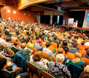
INTERNATIONAL CONFERENCE
11th International Conference on UNESCO Global Geoparks in 2025
Organized every two years, the International Conference on UNESCO Global Geoparks brings people together from across the world to share the latest findings and experiences on a wide variety of topics


GGN Map
News
Global Geoparks Network News
Connect with the Earth's Past Through the Global Geoparks Network's Stories


Who we are
GGN is an International Association on Geoparks
Officially established in 2014, is a non-profit international association of UNESCO Global Geoparks and Geoparks professionals subject to French legislation. The Global Geoparks Network is the official partner of UNESCO for the operation of the UNESCO Global Geoparks.
The GGN was initially founded in 2004 as an international partnership developed under the umbrella of UNESCO and serves to develop models of best practice and set quality-standards for territories that integrate the protection preservation of Earth heritage sites in a strategy for regional sustainable economic development.
UNESCO Global Geoparks
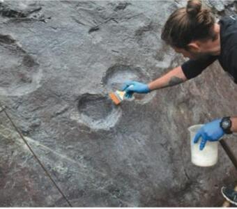
UNESCO Global Geoparks (UGGp) are single, unified geographical areas where sites and landscapes of international geological significance are managed with a holistic concept of protection, education and sustainable development.
What we do
Global Geoparks encourage awareness of the story of the planet as read in the rocks and landscapes.
The Global Geoparks Network is the international organisation of the Global Geoparks and Global Geopark professionals which is commited to the conversation, management and communication to society of the Earth heritage as ab integral part of the world's natural and cultural heritage, tangible and intangible.
Conservation & Enhancement
Global Geoparks are tools to conserve and enhance the value of areas of geological significance in Earth history,
Social Awareness
Global Geoparks encourage awareness of the story of the planet as read in the rocks and landscape.
Networking
Communication to society of the Earth heritage as an integral part of the world's natural and cultural heritage, tangible and intangible.
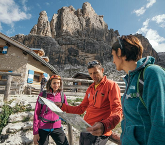
Discover the UNESCO Geoparks around the world
UNESCO Global Geoparks are Earth’s extraordinary places! New UNESCO destination of the XXI century, they are territories with landscapes and sites of an international geological significance
Film Festival
Best Geopark Promotional Video
A unique opportunity to mobilize both Geopark directors and Documentary Directors - filmmakers to collaborate in order to create new documentary and promotional videos on Geoparks.
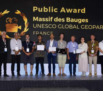
Festival Winners
The 2nd GGN International Film Festival was organized in parallel with the 10th International Conference on UNESCO

Participation
Candidate film makers interested need first to take contact with an UNESCO Geopark or official Aspiring UNESCO Geopark.
Partners
Global Geoparks Network has over 1,000 partners of all sizes
Working together with international partners is our main priority. UNESCO Global Geoparks get benefit through networking as members of the GGN, the international network of Geoparks and Geopark professionals.


Designed & Developed by Pelagus Creative Web